QAṢR AL-MAʿĪSARA
Place names
| Arabic | قصر المعيسرة |
| English | el-Me'ysera | el-Meyserah |
| French | Kasr Ma'esra |
Site map
Site information
| DEChriM ID | 37 |
| Trismegistos GeoID | 61698 |
| Pleiades ID | - | PAThs ID | - |
| Ancient name | - |
| Modern name | Qaṣr al-Maʿīsara |
| Latitude | 28.360801 |
| Longitude | 28.916879 |
| Date from | - |
| Date to | - |
| Typology | Village |
| Dating criteria | - |
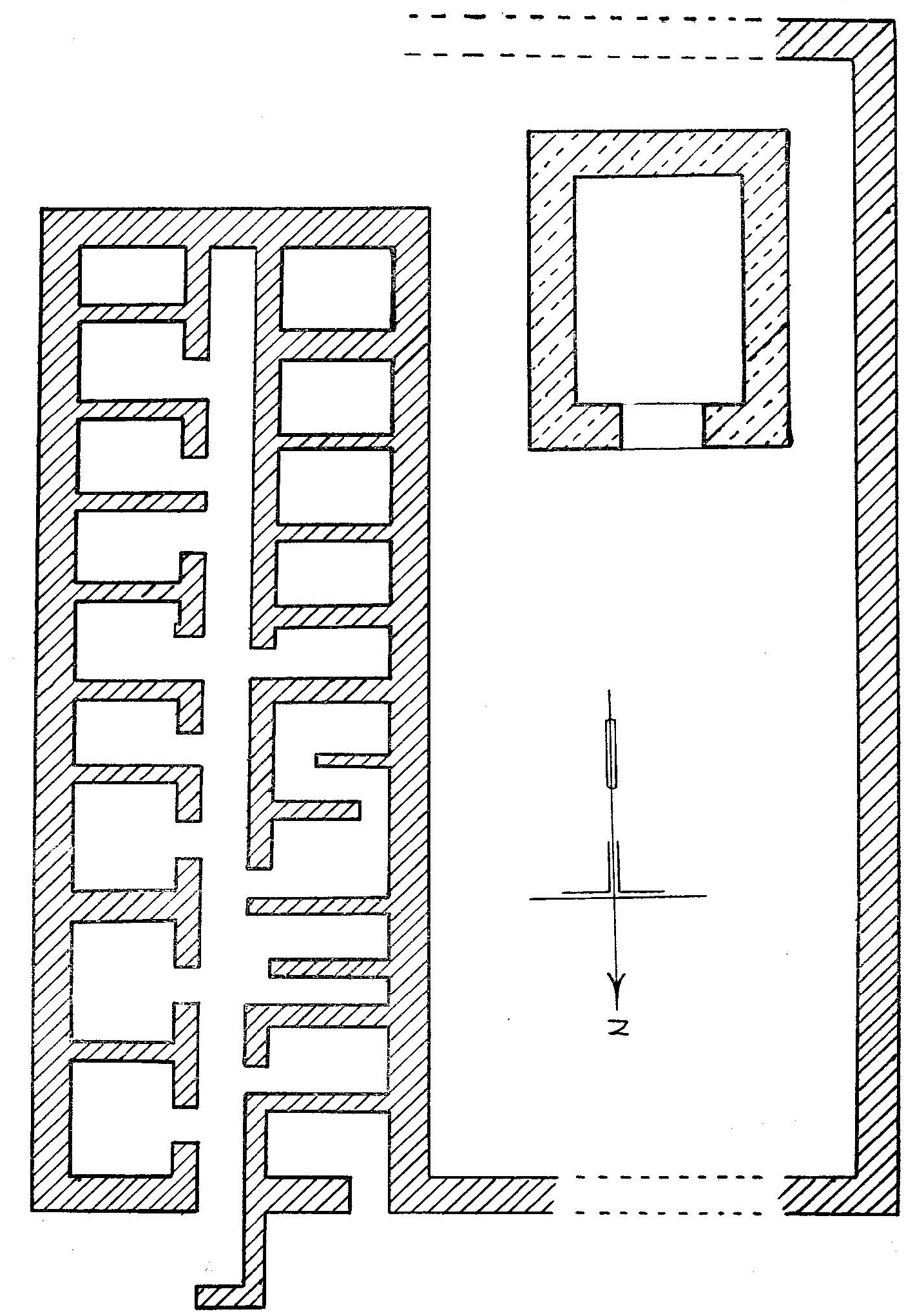
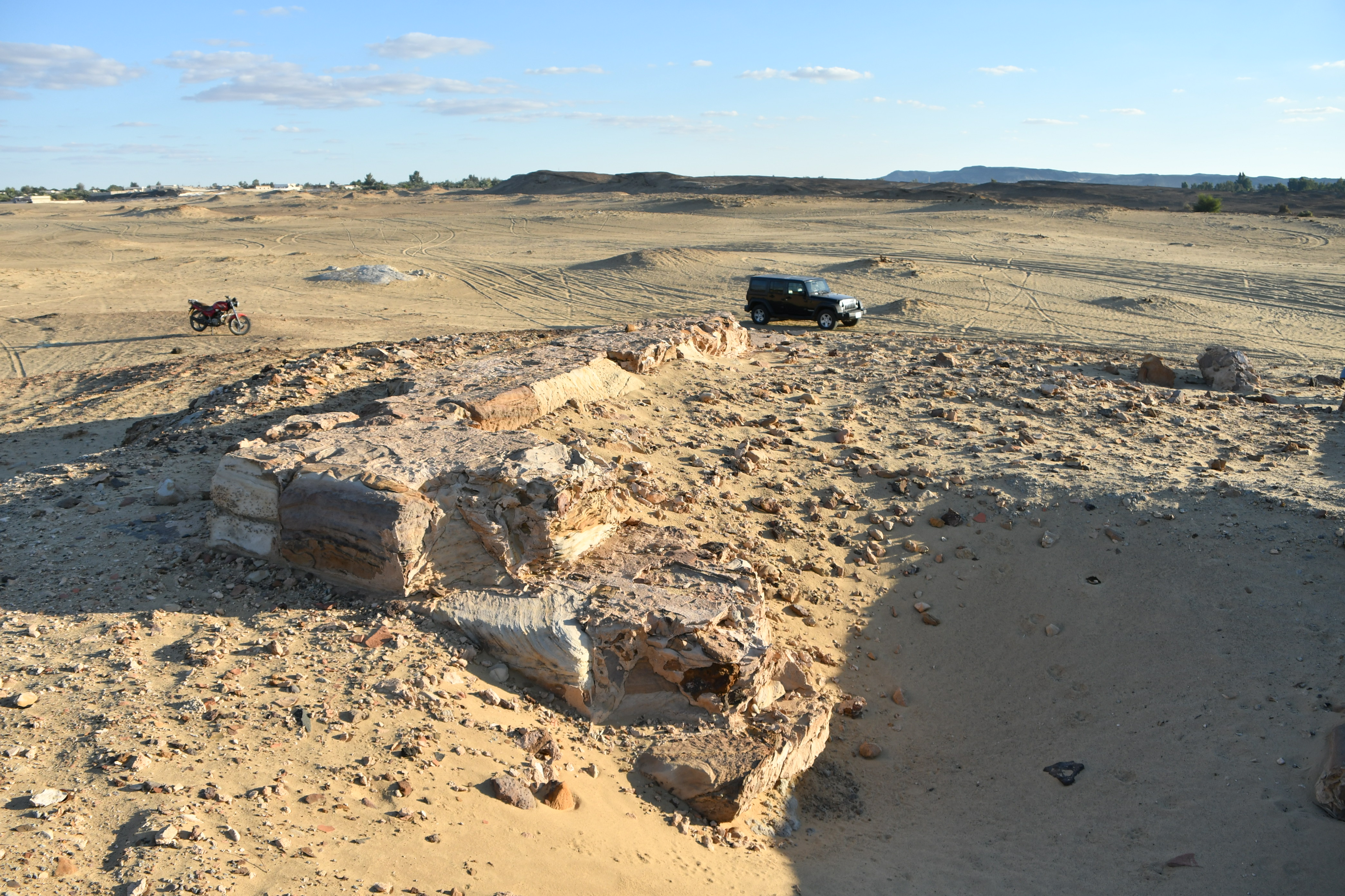
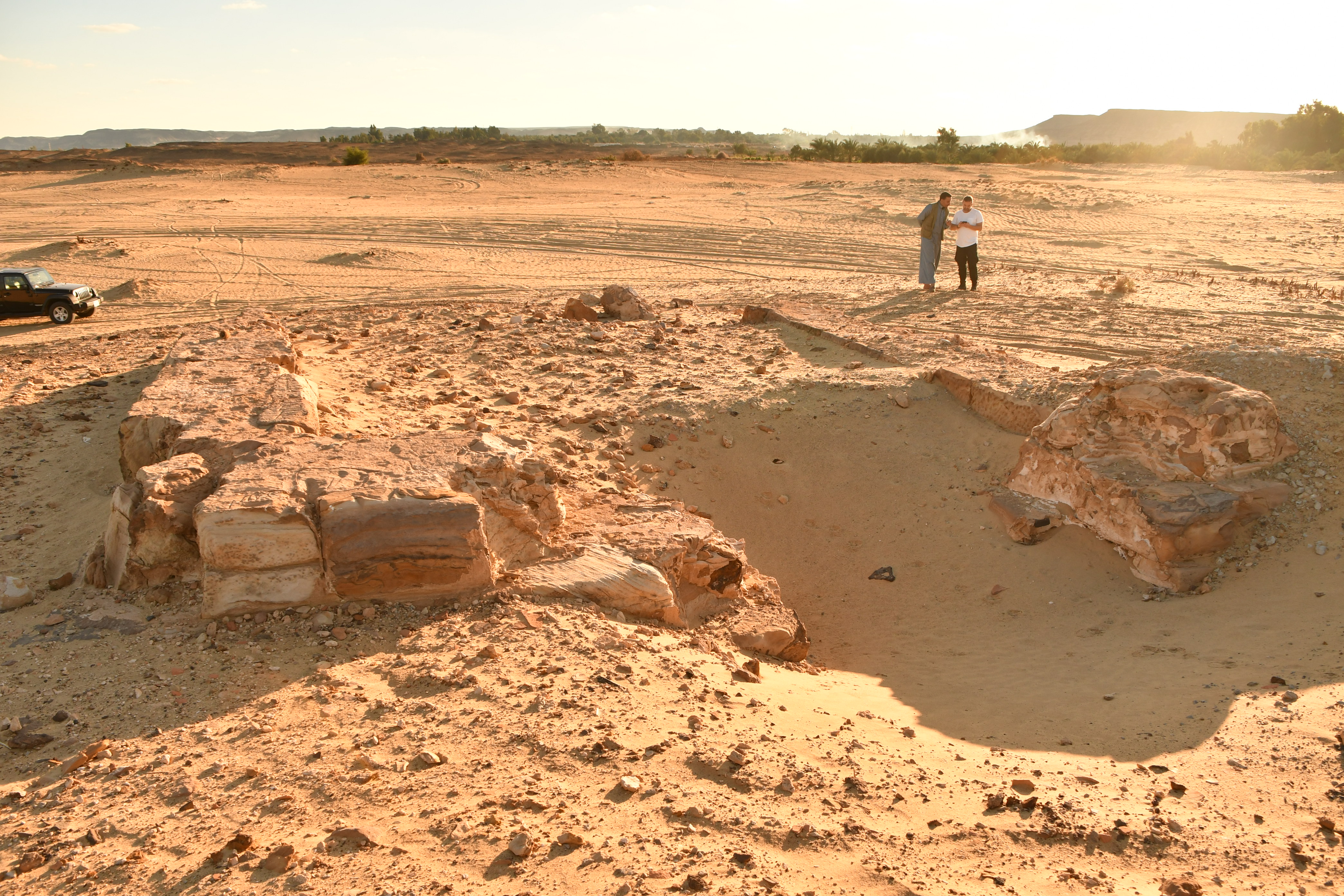
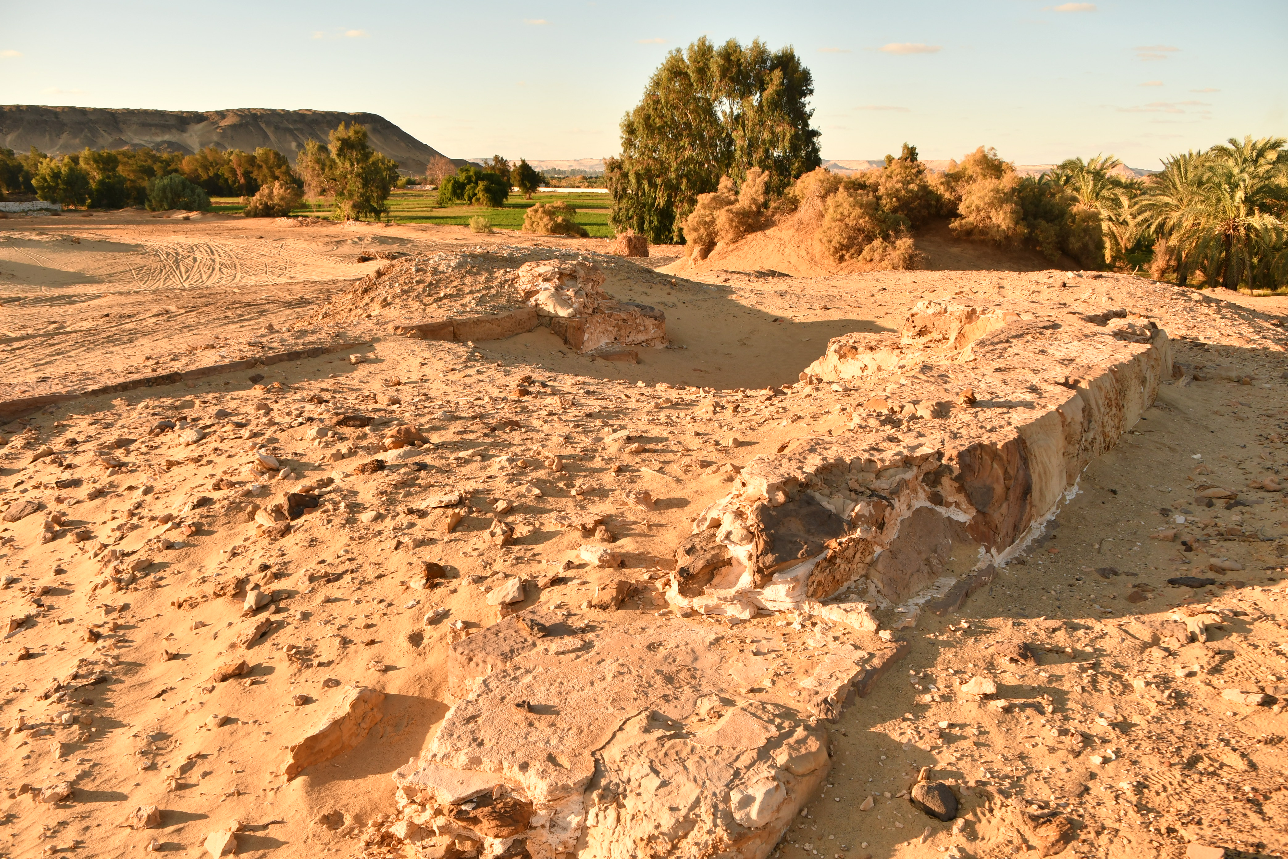
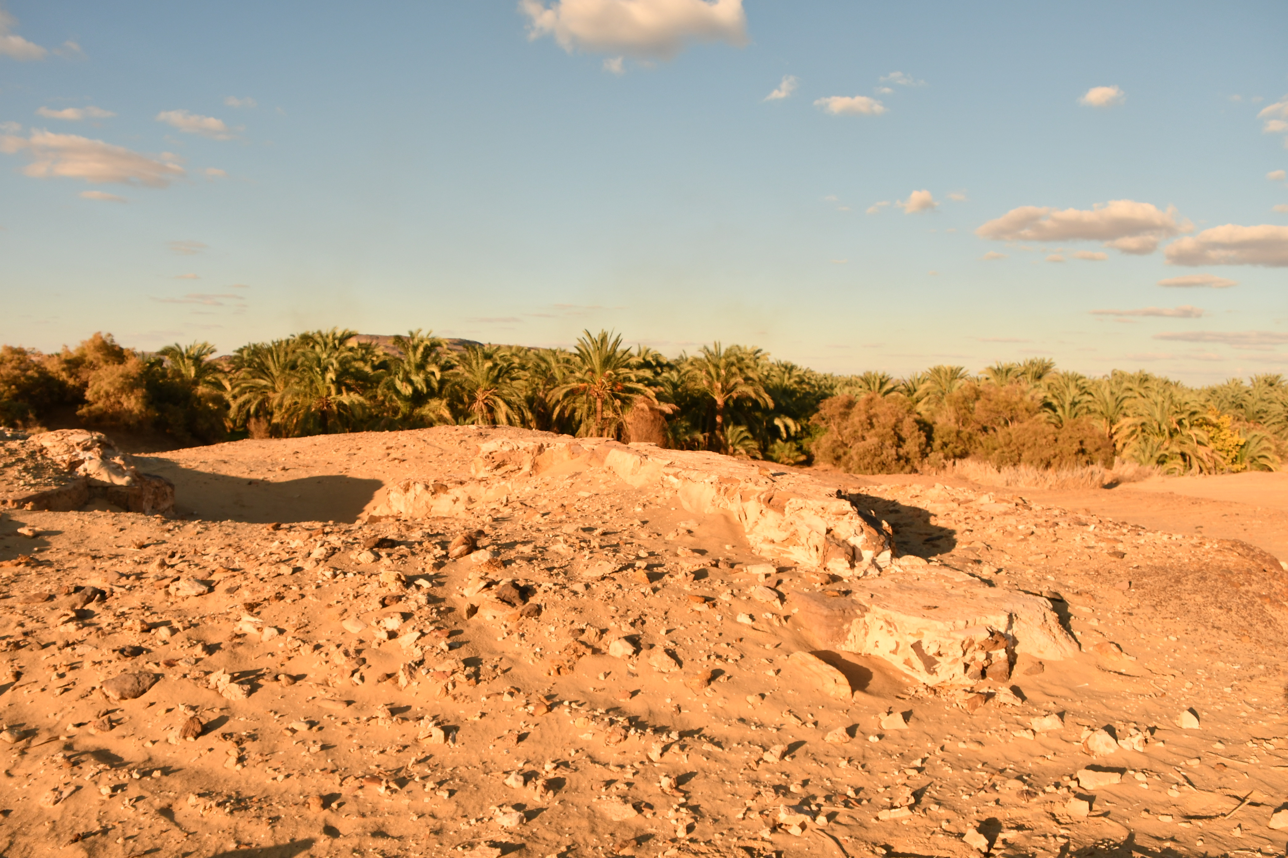
| Description | Qaṣr al-Maʿīsara, which Fakhry calls al-Mi’yṣrah, is situated in Baḥariya Oasis, 1.4km N/NE from the Roman village of Qaṣr al-ʿAǧūz. The site originally comprised a stone chapel, around which were numerous mud-brick buildings identified as domestic units which had been destroyed by fire in antiquity (Fakhry, 1950: 92). In these structures, Fakhry uncovered some 46 Greek and Coptic ostraca, amongst other artefacts, which document the presence of a Christian community (Ghica, 2012: 249). In a small ceramic vessel recovered from one of the burnt houses, which contained various gold and silver jewelry items, a gold coin of Emperor Valens was found, situating the occupation of the village no later than the fourth century (Fakhry, 1950: 92; Fakhry 1974: 105). The lower three courses of the stone chapel were said to have been in situ in 1938, when Fakhry first visited the site. When he returned later in the year, however, he says that he found that “all the stones had been taken away by one of the government engineers to build an enclosure for a spring at Mandīshah” (Fakhry 1974: 102). This raises a number of questions, as the location identified as Qaṣr al-Maʿīsara (based on the maps and plan of Fakhry) still houses the remains of a stone temple. Perhaps he simply exaggerated by saying “all” and meant, instead, that a large number of the stones had been removed? The ancient name of this small village is unknown, but a Greek ostracon (SB 20 14891 = O.Bahria 8) found on the site by Fakhry mentions a water reservoir (hydreuma) known as ὕ(δρευμα) Θαλμεν Πεχύσε[ως]. It could be assumed that this hydreuma was not too far away from Qaṣr al-Maʿīsara. |
| Archaeological research | The site was visited in 1938 by Ahmed Fakhry, who then conducted excavations in 1945 in the dwellings surrounding the chapel. No further fieldwork has been conducted, and very little information has ever been published. |
Bibliography
• Colin, F., D. Laisney and S. Marchand. 2000. “Qaret el-Toub: un fort romain et une nécropole pharaonique. Prospection archéologique dans l’oasis de Baḥariya 1999.” Bulletin de l’Institut français d’archéologie orientale 100: 153 and fig. 18.
• Fakhry, A. 1950. The Egyptian Deserts: Baḥaria Oasis, vol. 2, 92. Cairo: Government Press.
• Fakhry, A. 1974. The Oases of Egypt II: Bahriyah and Farafra Oases. Cairo: American University in Cairo.
• Ghica, V. 2012. “Pour une histoire du christianisme dans le désert Occidental d’Égypte.” Journal des savants 2: 249-250.
• Ghica, V. 2016. “Vecteurs de la christianisation de l’Égypte au IVe siècle à la lumière des sources archéologiques.” In Acta XVI Congressus Internationalis Archaeologiae Christianae, Rome 22-28.9.2013, edited by O. Brandt and G. Castiglia, 240. Città del Vaticano: Pontificio Istituto di Archeologia Cristiana.
Authors
Suggested citation
 Json data