ʿAYN ḤUSAYN
Place names
| Arabic | عين حسين |
| English | Ayn Husein |
Site map
Site information
| DEChriM ID | 42 |
| Trismegistos GeoID | 61700 |
| Pleiades ID | - | PAThs ID | - |
| Ancient name | - |
| Modern name | ʿAyn Ḥusayn |
| Latitude | 25.390498 |
| Longitude | 30.514021 |
| Date from | 300 |
| Date to | 400 |
| Typology | Village |
| Dating criteria | Radiocarbon analysis has not been conducted, and the SCA excavators did not study the ceramic, but, based on the general occupation of Kharga, which faltered in the fifth century, it is likely that this site dates from around the fourth century. |
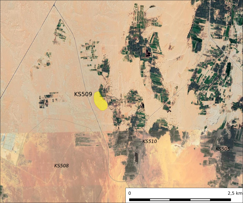
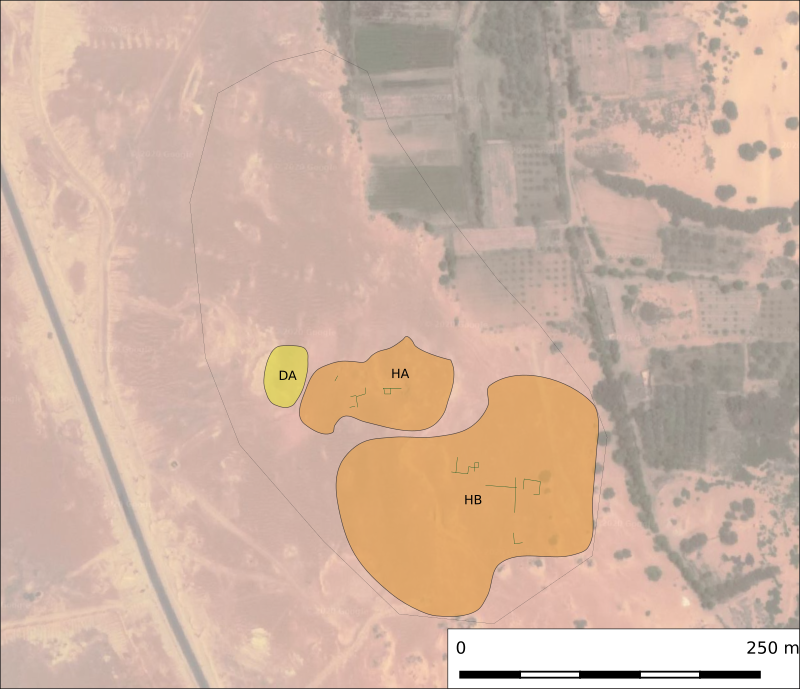
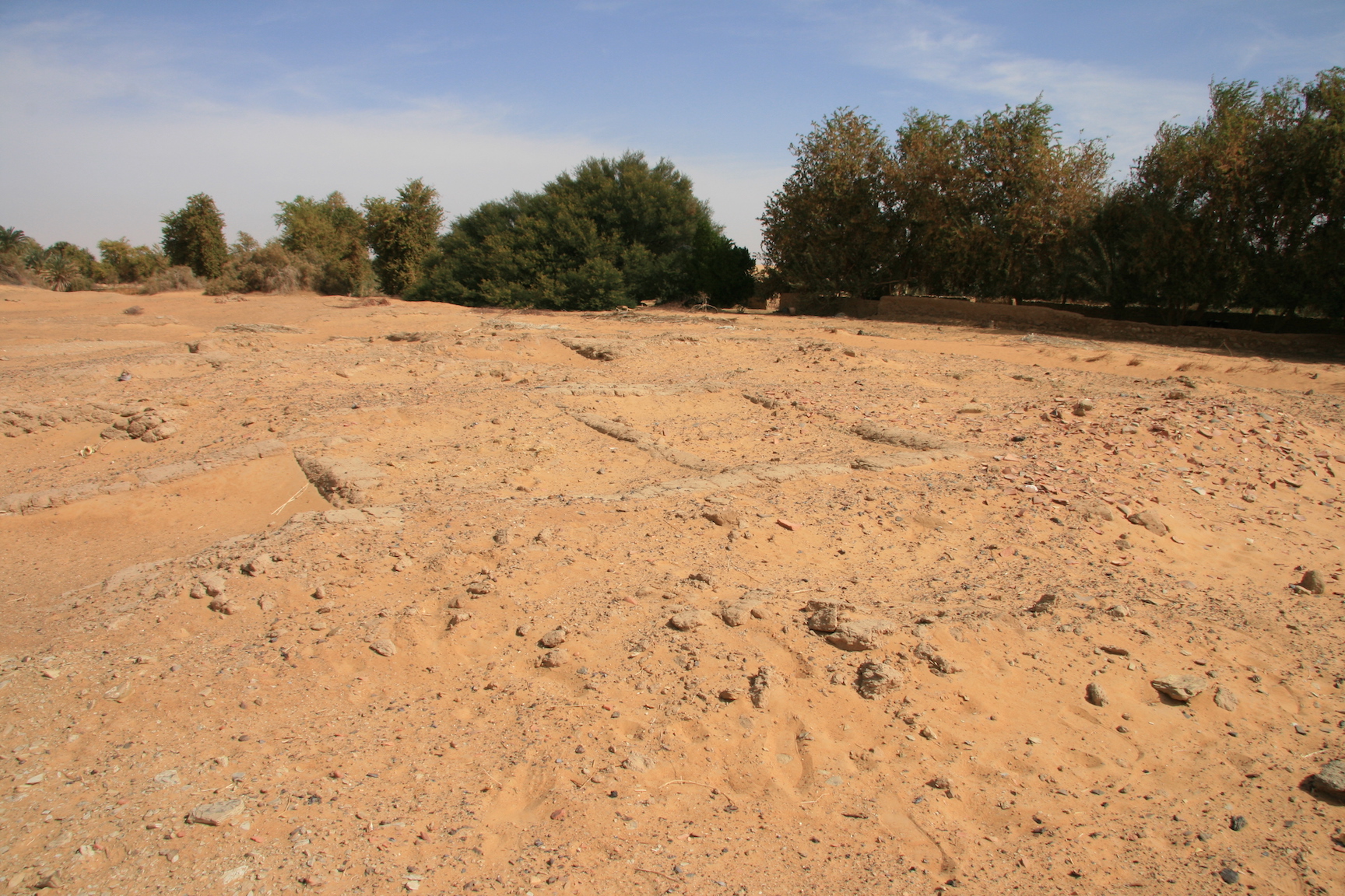
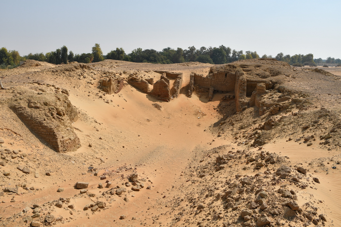
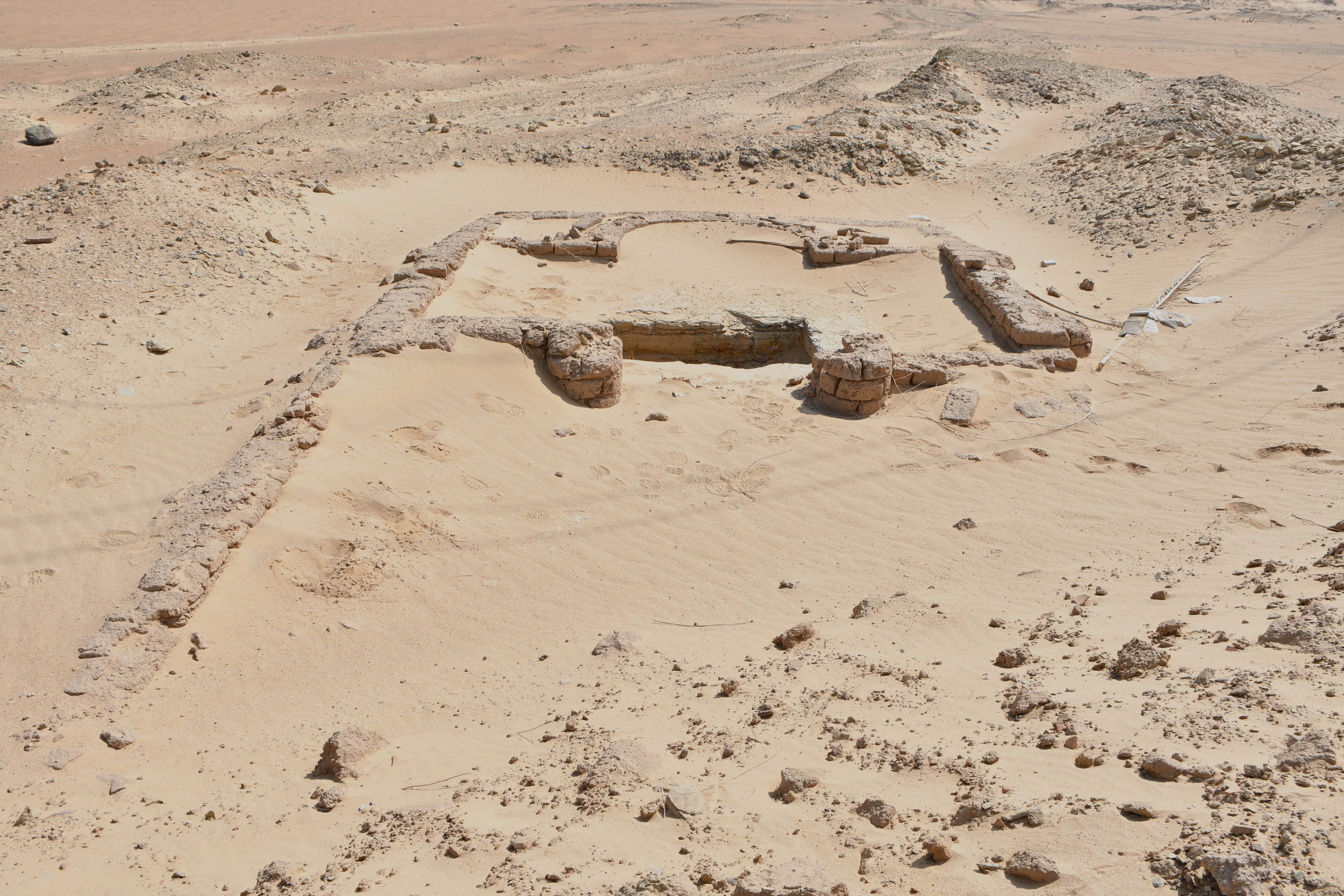
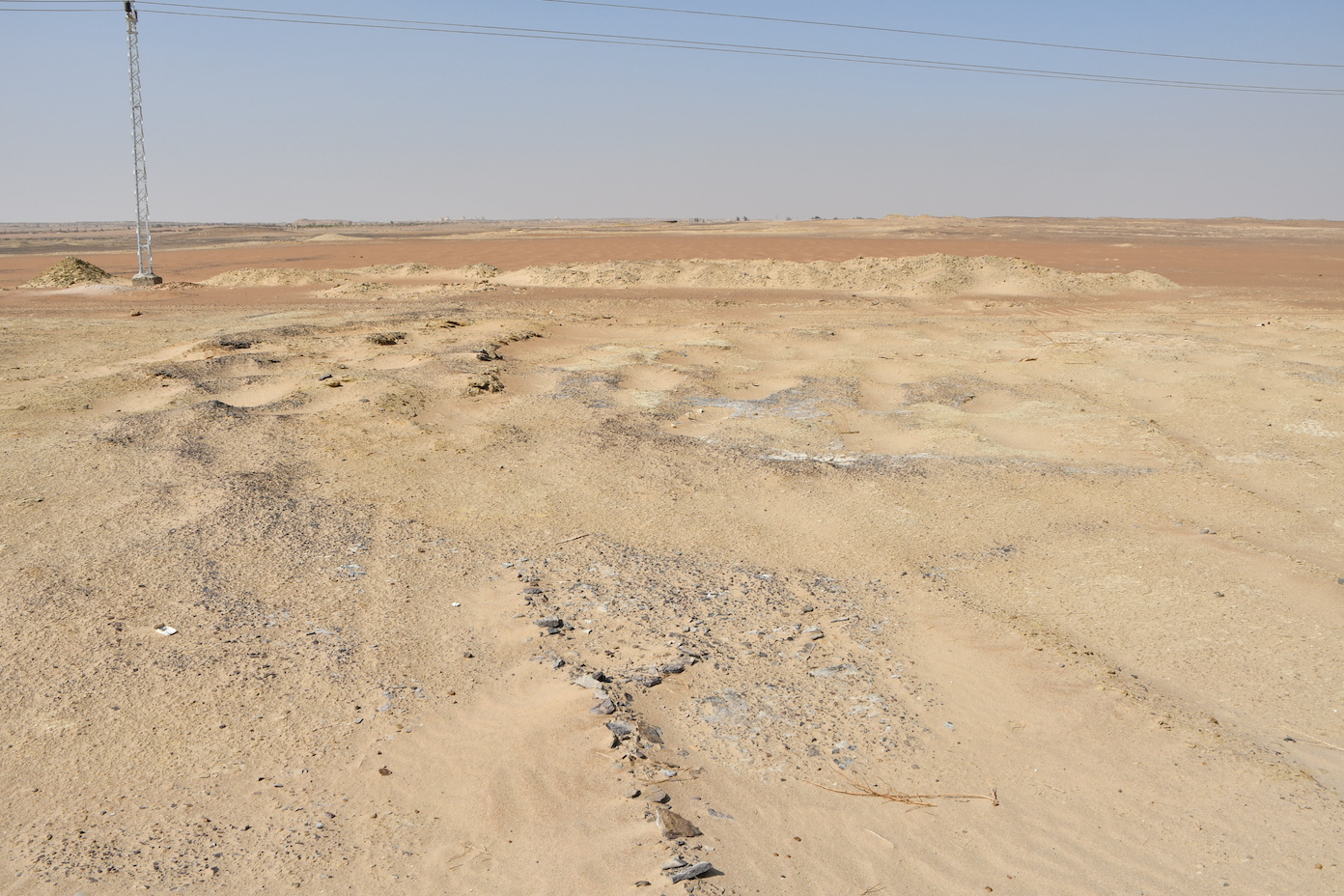
| Description | The settlement area is located some 250 meters to the east of the modern road, and has recently been severely disturbed by large machinery. The settlement is spatially removed from the small funerary church (c. 3.5 x 8m) and an associated cemetery, areas which are separated from one another by the modern road, with the church to the east and the cemetery to the west. Some 13 graves were excavated, many of which are now covered by the road. These graves are all simple pits dug in the sand, oriented on an east-west axis with heads to the west and no associated goods. The church is situated to the east, about 10 meters from the road, thanks to the construction workers who re-directed the path of the road so as to preserve the structure. The church, which is entered from the south, has a square opening in the floor of the sanctuary, said to have been originally covered with a stone slab. The hole opens to a shaft ca. 5m deep, with two chambers at the bottom, one to the east and one to the west. Apparently, these chambers were full of sand and water, and housed only disarticulated remains with no skulls. No anthropological analysis was conducted on the skeletal remains. |
| Archaeological research | ʿAyn Ḥusayn was prospected by Victor Ghica as part of the archaeological survey of the Darb al-Ġubbārī, which he carried out with Delphine Dixneuf in February 2009. A team of the South Kharga Oasis Survey surveyed the site briefly in January 2010. The local inspectorate of the Supreme Council of Antiquities carried out a one-month excavation season on the site in 2011, clearing 130 graves, some of which were subsequently destroyed by the asphalt road built after the end of the digs. Together with this group of burials, visible now to the west of the road, the adjacent church and a large well (ʿayn rūmānī) situated north of the church were also cleared. |
Bibliography
• Ghica, V. “Chrétiens d’Égypte dans le désert Occidental : implantations, développements, rapports avec les autres communautés (Ve-IXe siècle)”, in L. Pantalacci, S. Denoix (eds.), “Travaux de l’Institut français d’archéologie orientale 2008-2009”, Bulletin de l'Institut français d'archéologie orientale 109 (2009), pp. 647-651.
• Rossi, C., Ibrahim Ahmed, M. “Filling the gaps: towards a comprehensive list of archaeological sites in the Kharga Oasis, Egypt’s Western Desert”, in S. di Lernia, Marina Gallinaro (eds), Papers from the 1st Workshop Archaeology in Africa: Potentials and perspectives on laboratory & fieldwork research, Arid Zone Archaeology Monographs 8, Sesto Fiorentino, 2019, p. 97, col. A.
Authors
Suggested citation
 Json data