ʿAYN AL-TARĀKWA
Place names
| Arabic | عين التراكوة |
| English | Ain al-Tarakwa |
Site map
Site information
| DEChriM ID | 7 |
| Trismegistos GeoID | 61708 |
| Pleiades ID | - | PAThs ID | - |
| Ancient name | - |
| Modern name | ʿAyn al-Tarākwa |
| Latitude | 25.600878 |
| Longitude | 30.606688 |
| Date from | - |
| Date to | - |
| Typology | Village |
| Dating criteria | - |
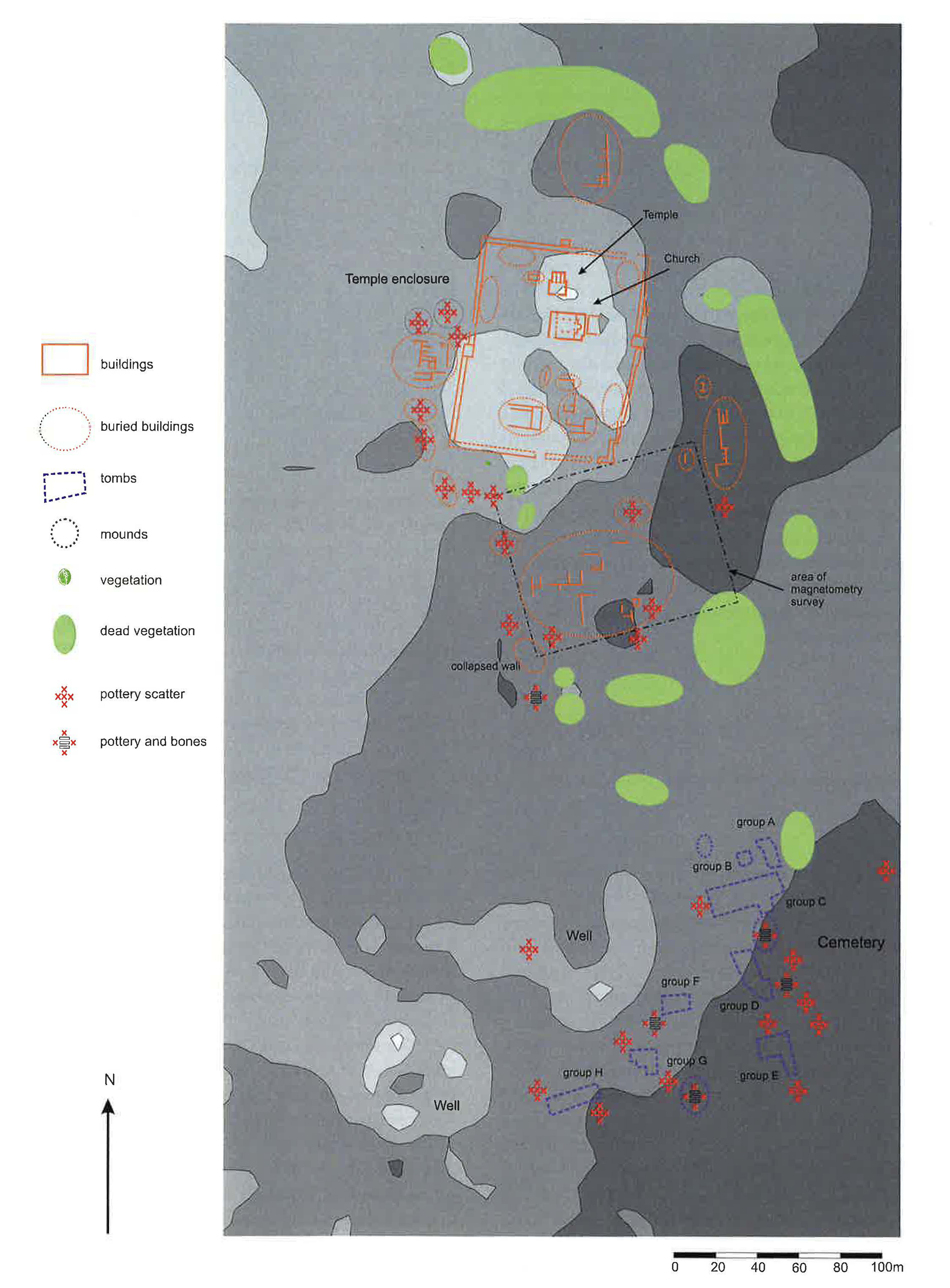
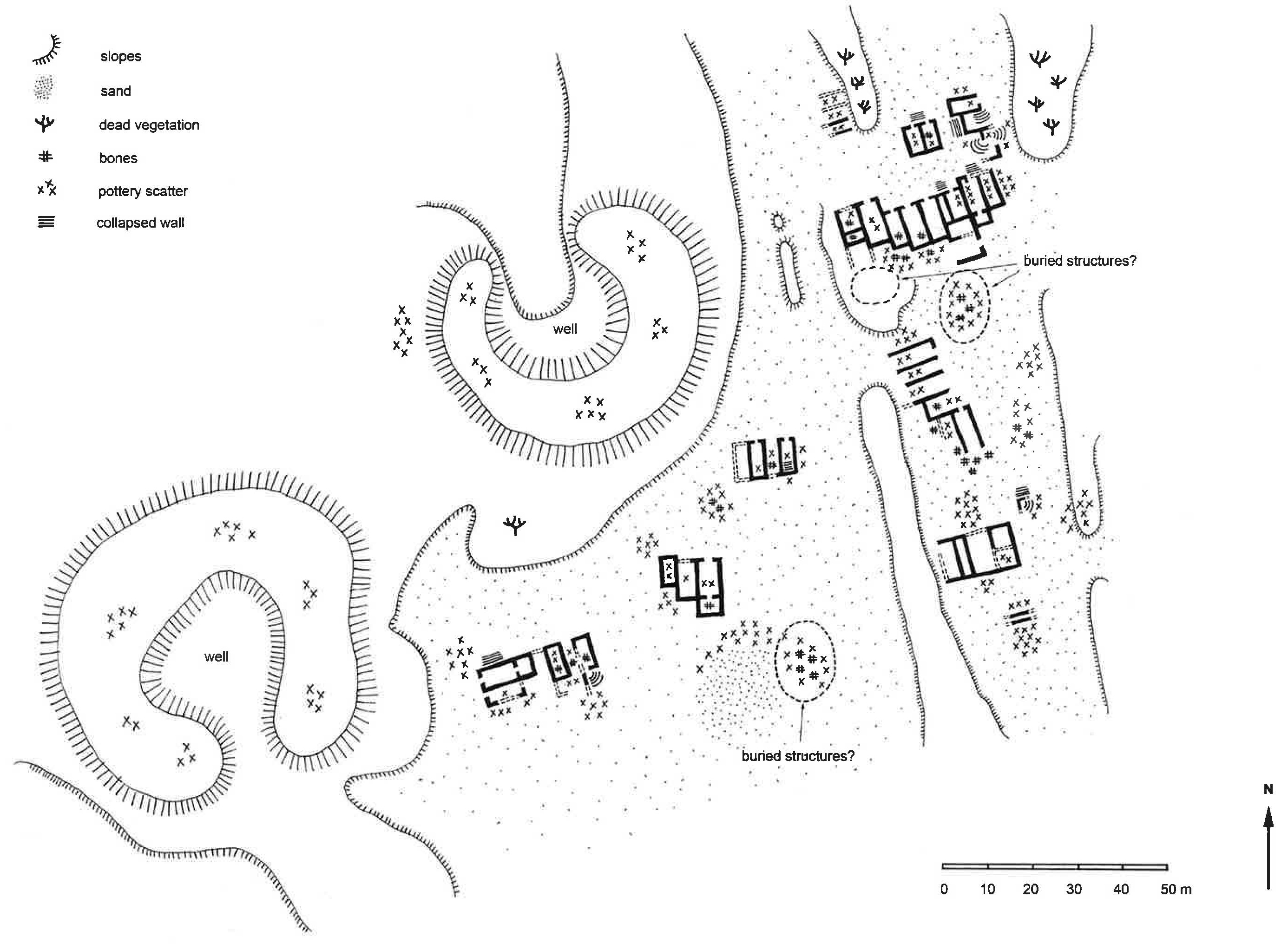
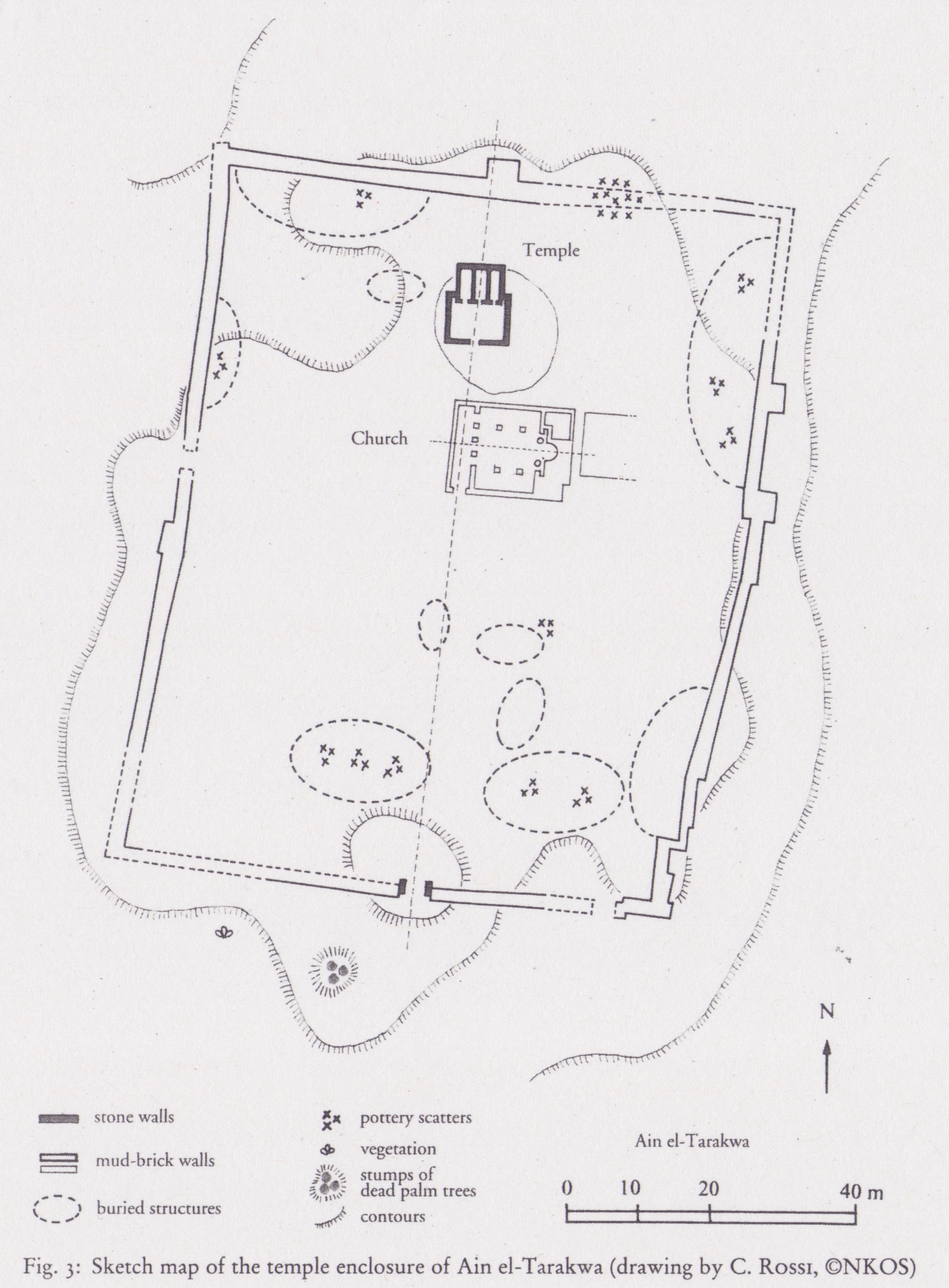
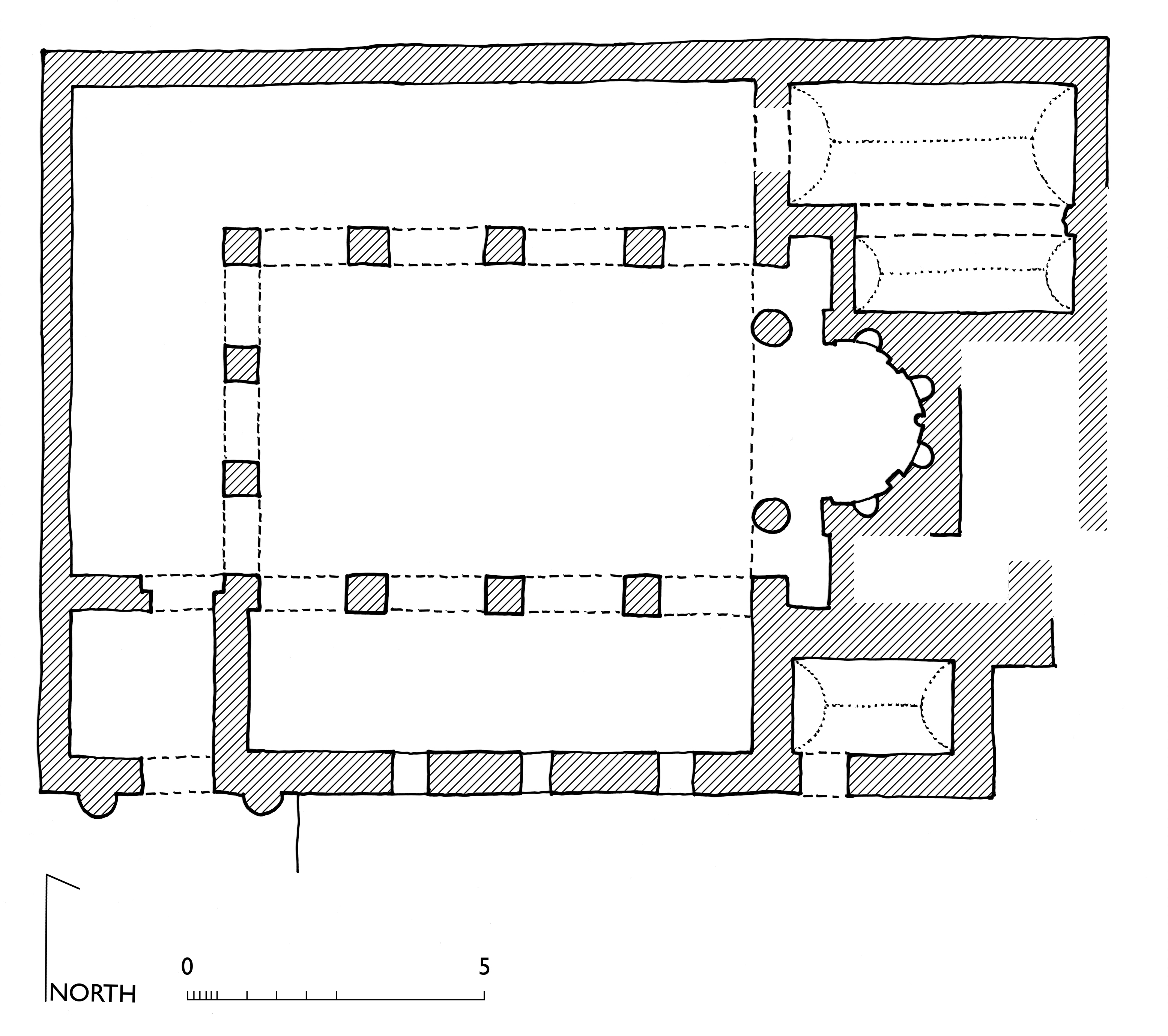
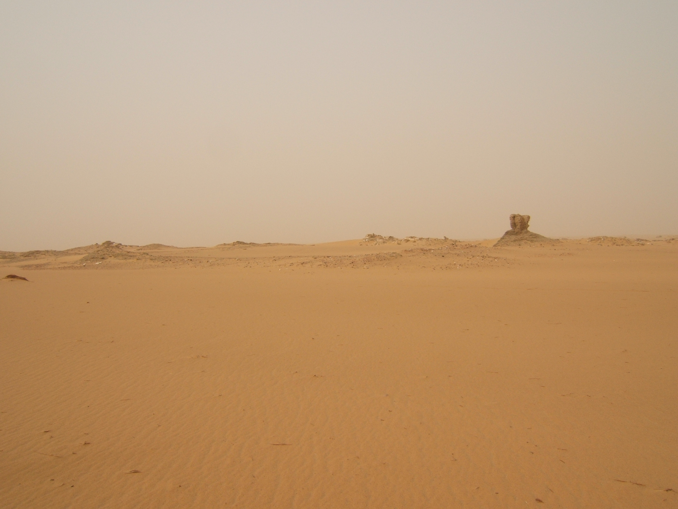
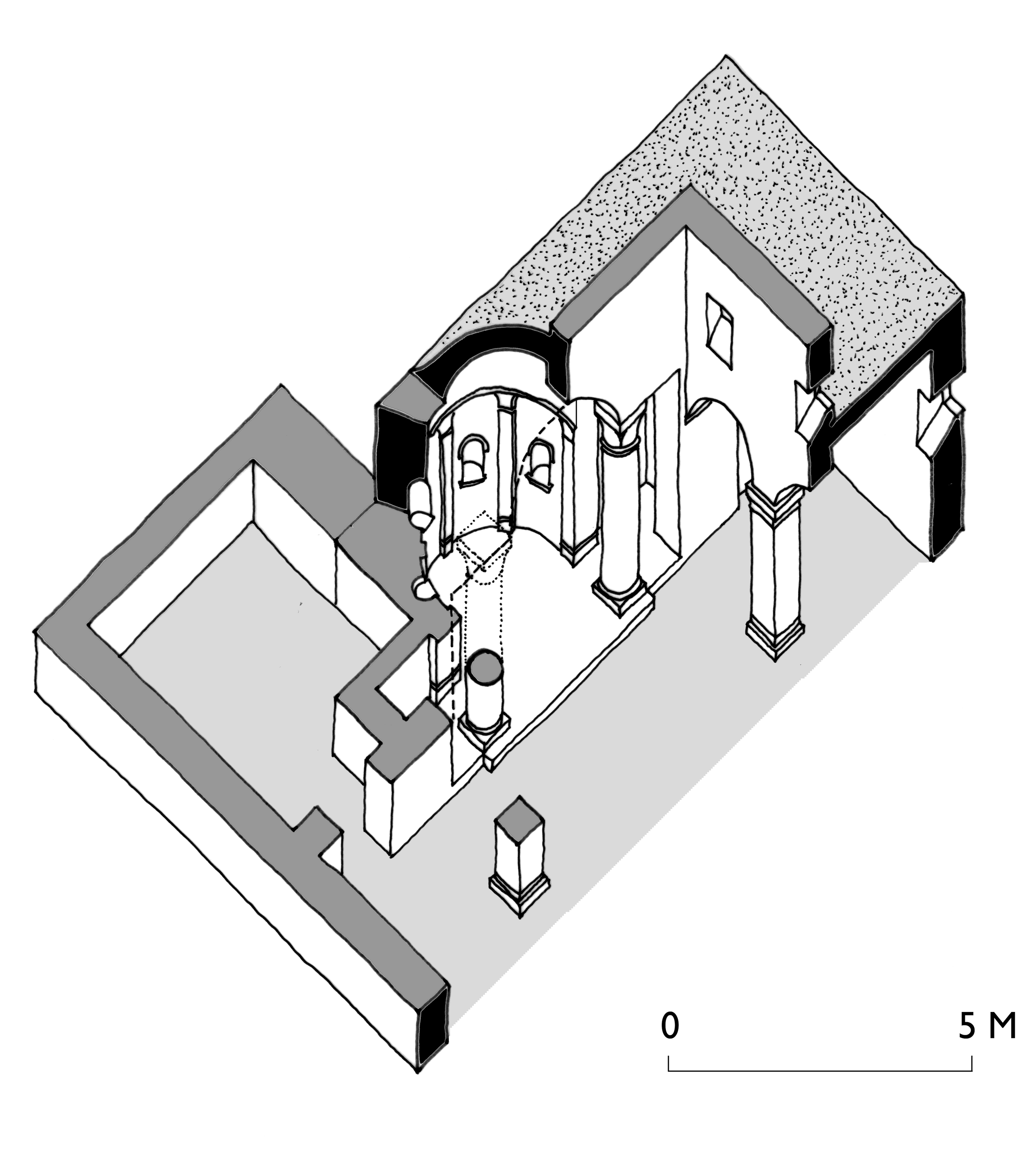
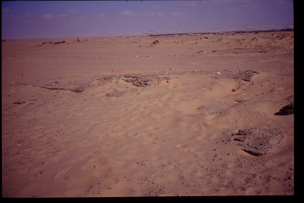
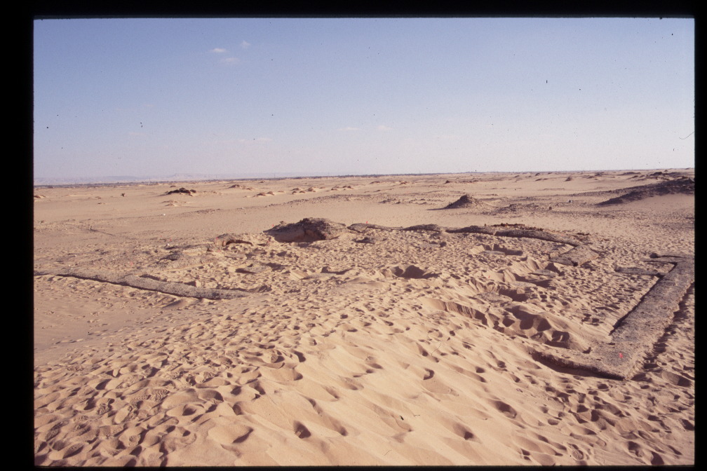
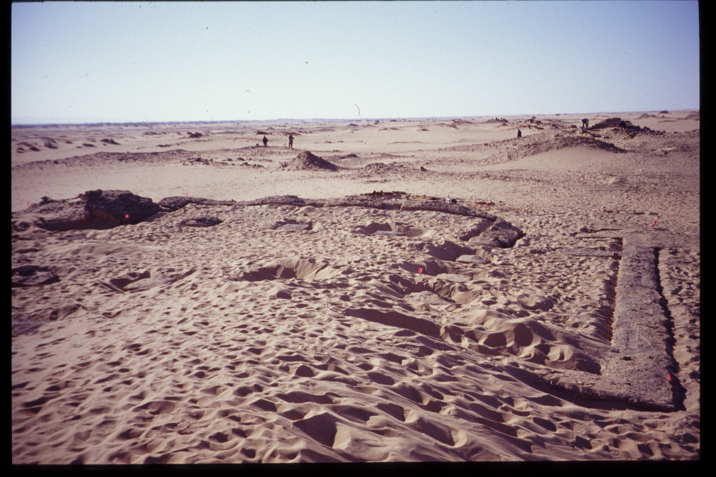
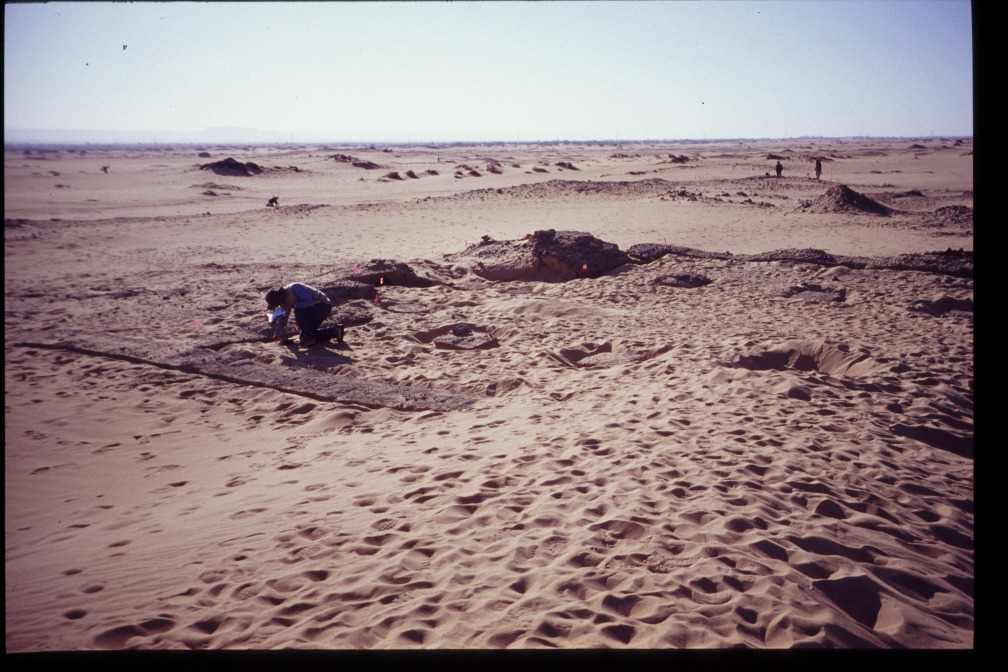
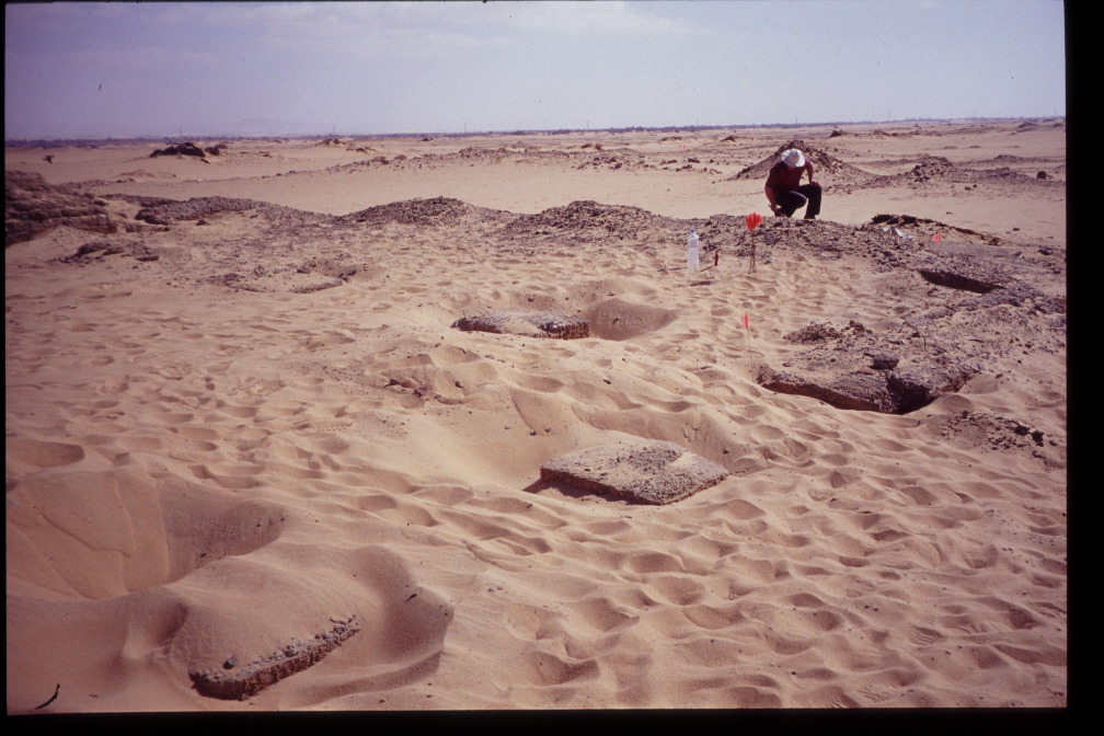
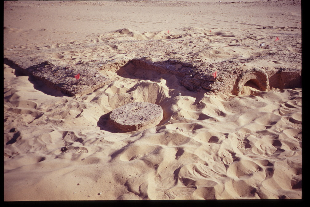
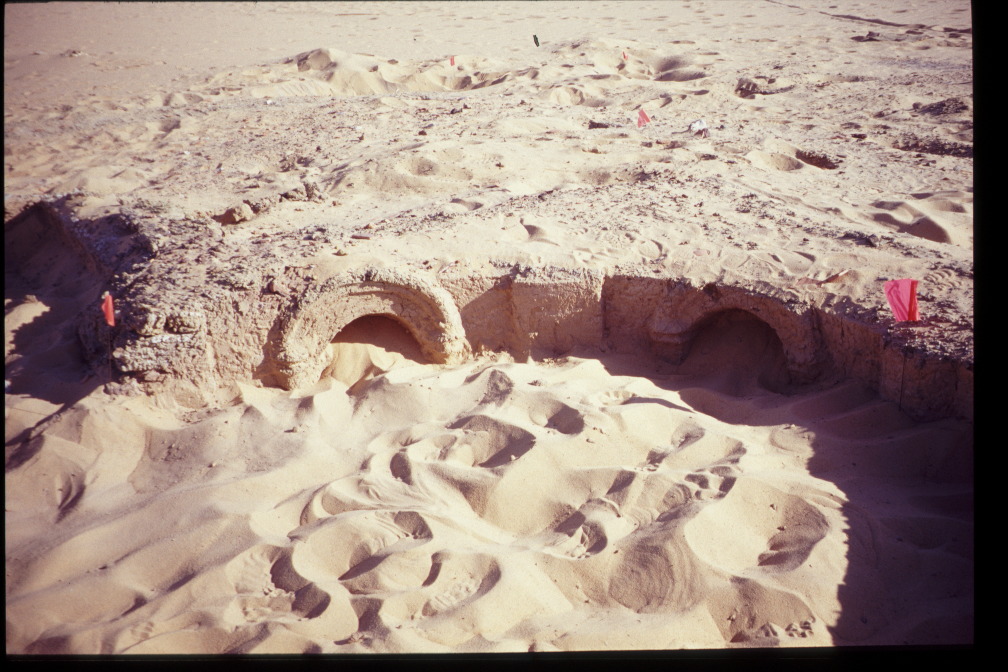
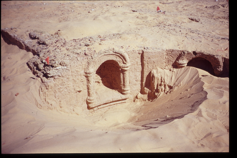
| Description | ʿAyn al-Tarākwa is located 20 kilometers north of Kharga town, and west of the village of Attara (Ikram and Rossi 2007: 167). The site has not yet been excavated, but preliminary information has been obtained thanks to the work carried out by the North Kharga Oasis Survey, a project co-directed by Corinna Rossi and Salima Ikram. According to the ceramic corpus, occupation of the site initially began in Ptolemaic times, intensifying in the 1st-3rd centuries CE, and lingering into the 4th and 5th (Rossi and Ikram 2018: 339). Dating the initial occupation is considerably difficult, however, with indications of Neolithic occupation, as well as potential for a New Kingdom foundation (Rossi and Ikram 2018: 341-2). The main identifiable features of the site are a small stone temple located inside a mud-brick enclosure wall, as well as a small church, a number of mudbrick structures, both inside and outside of the enclosure, and a number of wells (Rossi and Ikram 2018: 339). The temple, constructed on a N-S axis, is understood to date to the 3rd century CE. It has a large central chamber, which, along with the western chamber of the sanctuary, has been destroyed sometime in the last thirty years by looters (Ikram and Rossi 2007: 167). The well-built mud-brick structures situated outside of the enclosure wall are understood to belong to the phase of occupation associated with the temple (Rossi and Ikram 2007: 169). The use of this temple eventually ceased, at which point a secondary period of habitation commenced; this is when the church was built, and potentially when a number of the mudbrick structures inside the enclosure wall were constructed (Ghica 2012: 213). The church is deliberately positioned in such a way as to obscure access to the temple, with the entrance in the S-W corner aligning with the entrance to the enclosure and, consequently, changing the focal point of those entering the area (Ikram and Rossi 2007: 169). It is of basilical plan, with a tripartite nave and the central space separated from the side aisles by two rows of columns (Ikram and Rossi 2007: 169). The structure is considerably well-preserved, standing to the height of approximately two meters; the extensive sand cover, however, prevented any investigation of the circulation level (Rossi and Ikram 2018: 345). The rounded apse contains four niches, reminiscent of the entrances to the tombs at the al-Baǧawāt necropolis (Rossi and Ikram 2007: 169). Approximately 200 meters south of the temple enclosure, is a densely packed cemetery. Unlike the al-Baǧawāt necropolis, this cemetery is organised in a considerably regimented way, with well defined ‘streets’ (Rossi and Ikram 2018: 350). Its relatively close proximity to the temple and water sources has been interpreted by those on the field as an additional indicator of different periods of use of the site. The cemetery has subsequently been understood in association with the secondary/additional phase of habitation linked with the church (Rossi and Ikram 2018: 350). Tomasz Herbich conducted a magnetometry survey which showed a series of structures to the south of the temple enclosure. Unfortunately, without excavations their function cannot be determined. Similarly, excavation work would greatly assist in providing a solid foundation date for the site, as well as more informed interpretations of the structures in general. |
| Archaeological research | The site has not yet been excavated, but preliminary information has been obtained thanks to the work carried out by the North Kharga Oasis Survey (NKOS), a project co-directed by Corinna Rossi and Salima Ikram. As part of NKOS, Tomasz Herbich conducted a magnetometry survey in 2004. |
Bibliography
• Ghica, V. 2012. “Pour une histoire du christianisme dans le désert Occidental d’Égypte.” Journal des savants 2: 189-280.
• Ghica, V. 2016. “Vecteurs de la christianisation de l’Égypte au IVe siècle à la lumière des sources archéologiques.” In Acta XVI Congressus Internationalis Archaeologiae Christianae, Rome 22-28.9.2013, edited by O. Brandt and G. Castiglia, 248-249 and fig. 9f. Città del Vaticano: Pontificio Istituto di Archeologia Cristiana.
• Ikram, S. and C. Rossi. 2002. “Surveying the North Kharga Oasis.” KMT: A Modern Journal of Ancient Egypt 13/4: 72-79.
• Ikram, S. And C. Rossi. 2007. “North Kharga Oasis Survey 2004 Preliminary Report: Ain el-Tarakwa, Ain el-Dabashiya and Darb Ain Amur.” Mitteilungen des Deutschen Archaologischen Instituts Abteilung Kairo 63: 167-184.
• Rossi, C. and S. Ikram. 2018. North Kharga Oasis Survey: Explorations in Egypt’s Western Desert. Leuven, Paris, Bristol: Peeters.
• Wagner, G. 1987. Les oasis d’Égypte à l’époque grecque, romaine et byzantine d’après les documents grecs: Recherches de papyrologie et d’épigraphie grecques. Cairo: Institut français d’archéologie orientale.
Authors
Suggested citation
 Json data