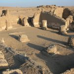
ŠAMS AL-DĪN (MOUNĒSIS)
| Greek | Μουνησις | Μωνησις | Πμουν Ἠσε |
| Coptic | pmou nhse |
| English | Shams al-Din |
| French | Chams el-Din | Chams ed-Din | Aïn Chams el Din |
| DEChriM ID | 2 |
| Trismegistos GeoID | 3155 |
| Pleiades ID | 776216 | PAThs ID | - |
| Ancient name | Mounēsis |
| Modern name | Šams al-Dīn |
| Latitude | 24.695961 |
| Longitude | 30.601341 |
| Date from | 200 |
| Date to | - |
| Typology | Village |
| Dating criteria | - |
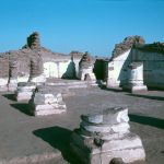
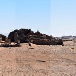
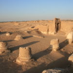
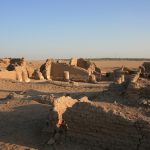
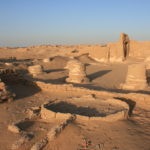
| Description | The Romano-Byzantine site of Šams al-Dīn, ancient Mōnēsis, is located 18 kilometers N-W of Dūš, on the ancient caravan route connecting Lycopolis and Hibis. Limited archaeological excavation has been conducted here, with only the church, located in the S-W corner of the perimeter of the ancient residential area, having been investigated (Ghica 2012: 216). Excavations were carried out in 1975, led by Guy Wagner and Jean Gascou, in association with the Institut Français d’Archéologie Orientale. The church, which is of simple basilica type, is believed to have been erected in the mid to latter half of the fourth century CE (Wagner 1987: 358-359; Timm 1984-1992: 2264). It is without an apse, and has a rectangular sanctuary, with two rows of columns delimiting three naves. A seventh column is located in the center of the wall opposite the sanctuary and completes the support of the roof (Sauneron 1976: 411). Much of the significance of the site derives from the numerous Greek graffiti and dipinti inscribed on the walls of the choir, of the vestibule, of the corridor leading to the church and of the room receiving travellers (kathesterion), totaling to around seventy (Wagner 1987: 27-43). These inscriptions are not only incredibly informative regarding faith and worship at the time, including reference to a high number of Christian soldiers stationed at Mōnēsis, but are an indispensable means of dating the structure. As well as the graffiti, a number of objects of worship were also uncovered, including five Greek ostraka (4th century) and a plaque in wood (3rd century) (Wagner 1987: 182). |
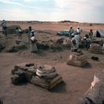
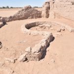
| Archaeological research | The site is said to have first been identified by the raʾīs of Ahmed Fakhry, though exactly when, and whether or not it piqued Fakhry’s interest, is unknown (Sauneron 1976: 410). In March 1975, the year before excavations began at the more renowned nearby site of Dūš, Guy Wagner and other members of the Institut français d’archéologie orientale (IFAO) visited the site. In June of the same year, then-director of IFAO, Serge Sauneron, conducted a test survey in the so-called kathesterion where the Greek graffiti adorning the walls was partially visible above the sand coverage (Wagner 1987: 27). A two-week-long excavation campaign was then conducted in January/February of 1976, directed by Guy Wagner and Jean Gascou. This work saw the excavation of the church, part of the 'portico' to the west (namely the basin), and the kathesterion to the south. Only a brief report was ever published with regards to this work (Sauneron 1976), while the written documents, comprising some 67 graffiti and six ostraca, were published in the doctoral thesis of Wagner (Wagner 1987: 27-43). These written documents were certainly the key interest for the excavators, but this unfortunately meant that the church structure remained relatively unknown, with not so much as a plan having been published. In 2005, the site was surveyed as part of the large-scale survey project of IFAO dedicated to the south of Kharga – now denoted the South Kharga Oasis Survey (SKOS) which is hosted here on the DEChriM website. The site received the identifier KS177. In February 2020, a team led by Basem Gehad carried out DGPS, TLS and photogrammetric surveys of the site in preparation for the first DEChriM field season, which was conducted October 18th-November 4th, 2021. This work saw the excavation of a Late Roman temple to the north of the church, as well as a detailed study of the masonry of the church and the buildings surrounding it (Ghica et al. 2023). In December 2022, a second, smaller-scale mission was conducted by DEChriM at the site, dedicated to investigating the area immediately north of the church. Additional photography was done in order to add the newly excavated area to extant photogrammetric models, as well as a preliminary attempt as creating a photogrammetric model of the whole site. The report containing the results of this season is forthcoming. |
• Ghica, V. 2012. “Pour une histoire du Christianisme dans le désert occidental d’Égypte.” Journal des savants 2: 189-280.
• Ghica, V. 2016. “Vecteurs de la christianisation de l’Égypte au IVe siècle à la lumière des sources archéologiques.” In Acta XVI Congressus Internationalis Archaeologiae Christianae, Rome 22-28.9.2013. edited by Olof Brandt, Gabriele Castiglia, 241-242, 248-249 and fig. 9i. Città del Vaticano: Pontificio Istituto di Archeologia Cristiana.
• Ghica, V., R. Williams, B. Gehad, M. Elefante, R. David, N. Morand. 2023. “The 2021 Excavation Season at Šams al-Dīn (Kharga Oasis).” Analecta papyrologica 36: 149-202.
• Grossmann, P. 1989. “Neue fru?hchristliche Funde aus Ägypten.” In Actes du XIe congrès international d’archéologie chrétienne. Lyon, Vienne, Grenoble, Genève, Aoste, 21-28 septembre 1986. 1899-1900. Rome: École française de Rome.
• Sauneron, S. 1976. “Travaux de l’IFAO, en 1975-1976.” Bulletin de l’Institut français d’archéologie orientale 76, 410-411.
• Timm, S. ed. 1984-1992. Das christlich-koptische Ägypten in arabischer Zeit: Eine Sammlung christicher Stätten in Ägypten in arabischer Zeit unter Ausschluß von Alexandria, Kairo, des Apa-Mena-Klosters (D?r Ab? Mina), der Sk?tis (W?di n-Na?r?n) und der Sinai-Region. Vol. V (Q-S), Beihefte zum Tübinger Atlas des Vorderen Orients B 41/5. Wiesbaden:: Dr Ludwig Reichert. 2264-2269.
• Wagner, G. 1987. Les oasis d’Égypte à l’époque grecque, romaine et byzantine d’après les documents grecs: recherches de papyrologie et d’épigraphie grecques. Cairo: Institut français d’archéologie orientale.


 Json data