The earliest occupation phase of the East sector (end of 4 c.) is dated on the basis of evidence provided by the Greek ostraca found on the site. The trilingual (Demotic, Greek, Coptic) ostracological material uncovered on the site (a situation encountered also at Dūš and Dayr al-Baǧawāt, sites from the same oasis); the type of documents (e.g. lease agreements, similar to those found at Dūš and ʿAyn al-Wāqifa); the onomastics/prosopography (including names attested at Dūš and ʿAyn al-Wāqifa); and metrology (including several units well attested on 4 c. sites both in Kharga and Dakhla) point towards an occupation in the second half of 4 c. A radiocarbon age obtained for mudbricks sampled in the church of the East sector gives the range 430-560 (Ghica 2012: 222, n. 184). The latest period is suggested by the Coptic graffiti.
For the West sector, we have a C14 date (532-604) in addition to two coins found in surface drift 23/2/2021 for which the last date of emission is 329. (Ghica 2012: 224, n. 192).
Description
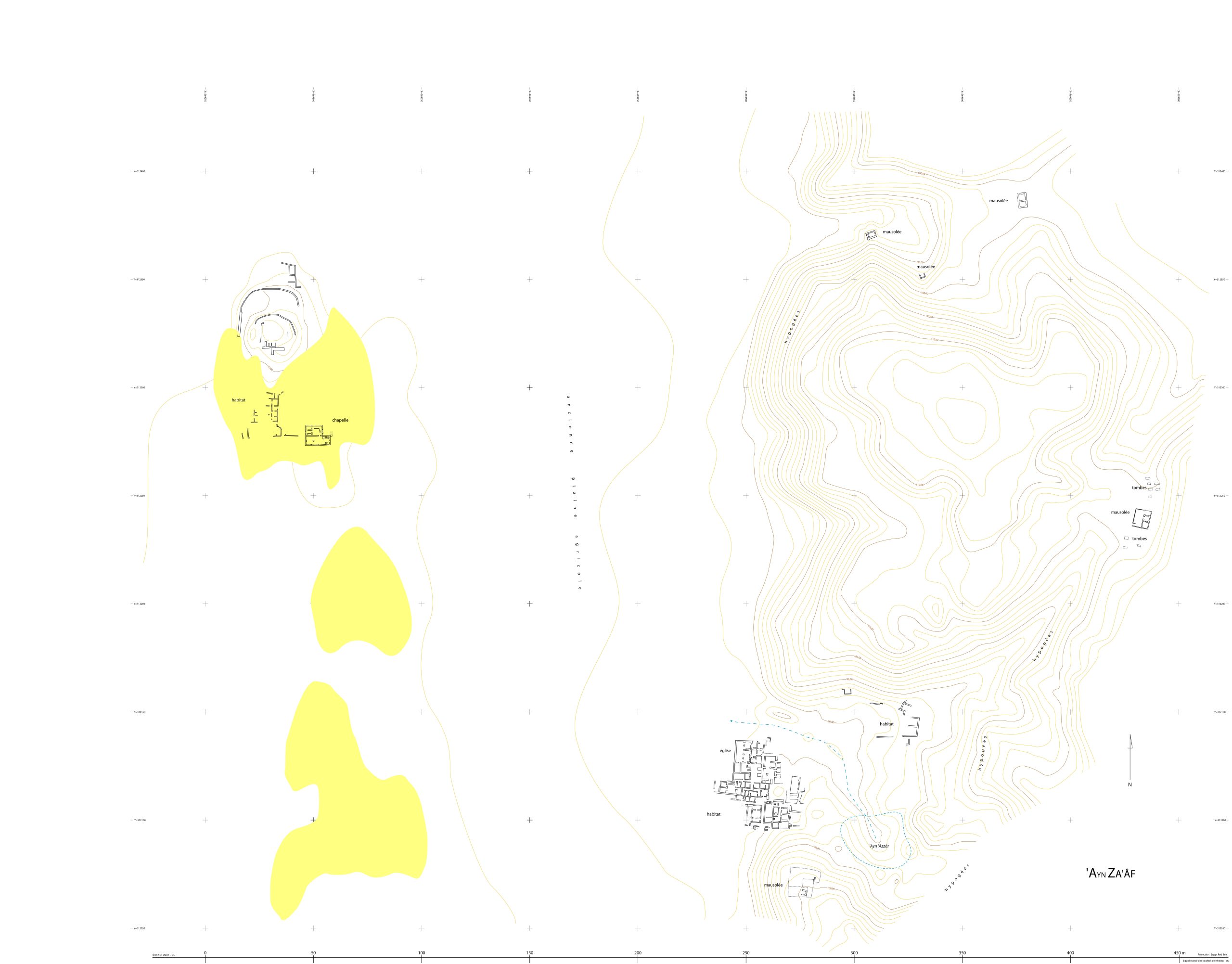
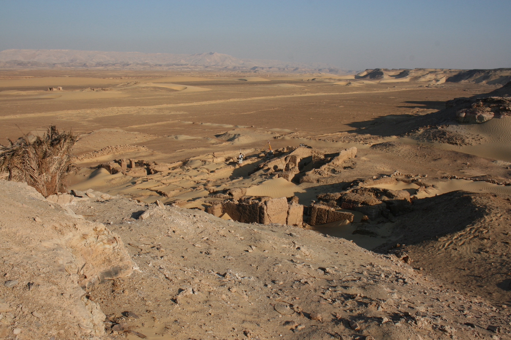
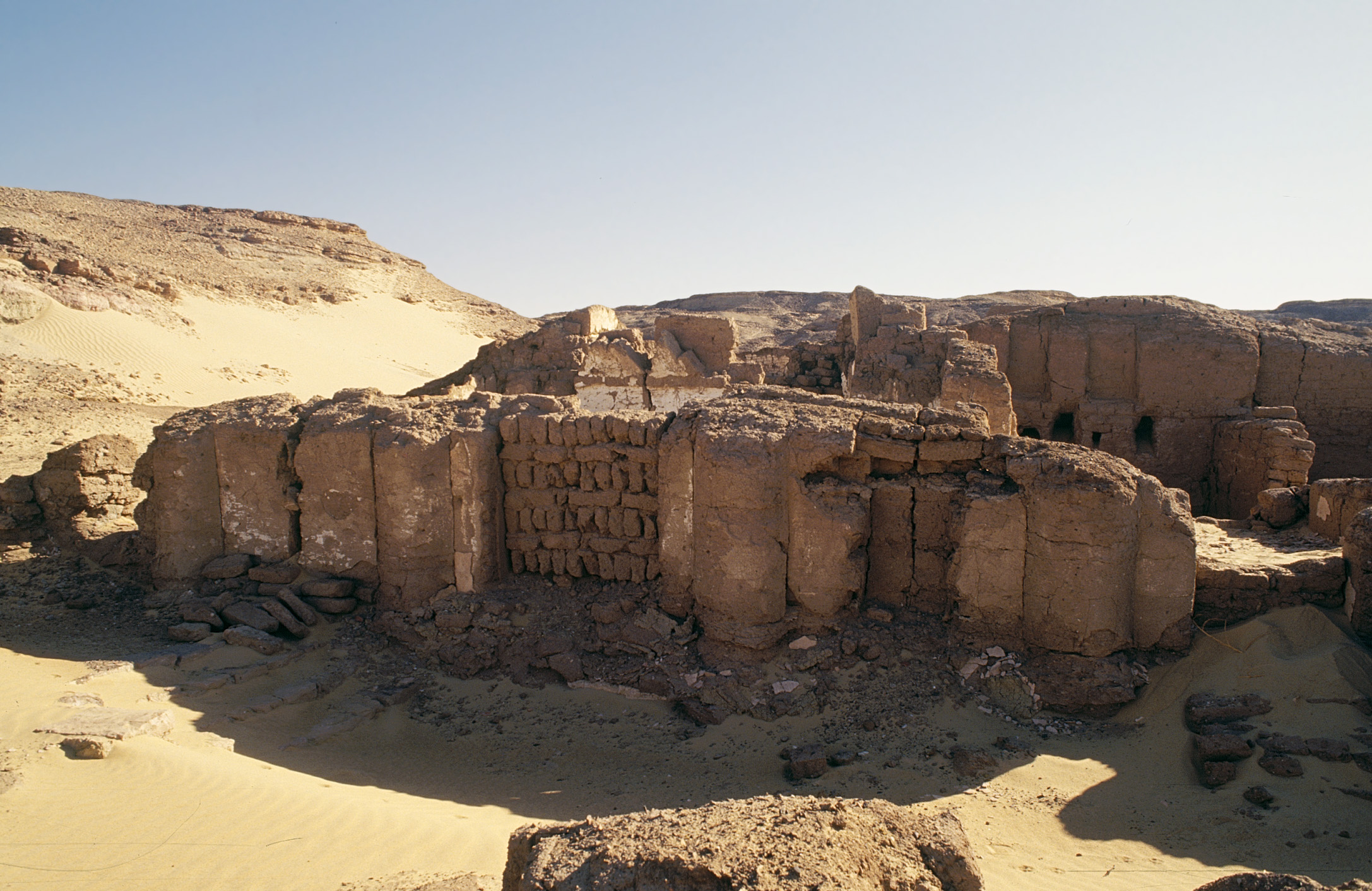
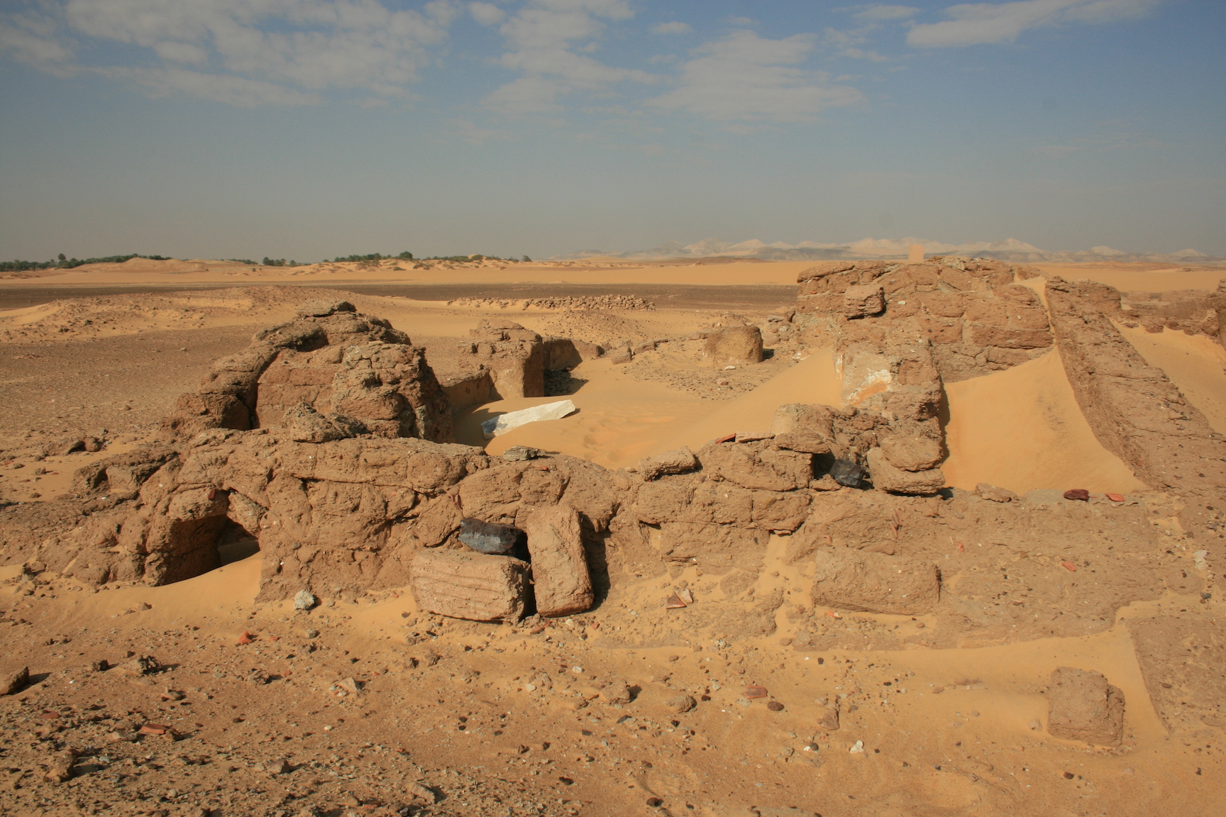
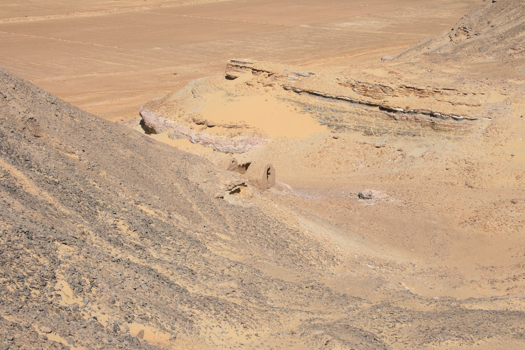
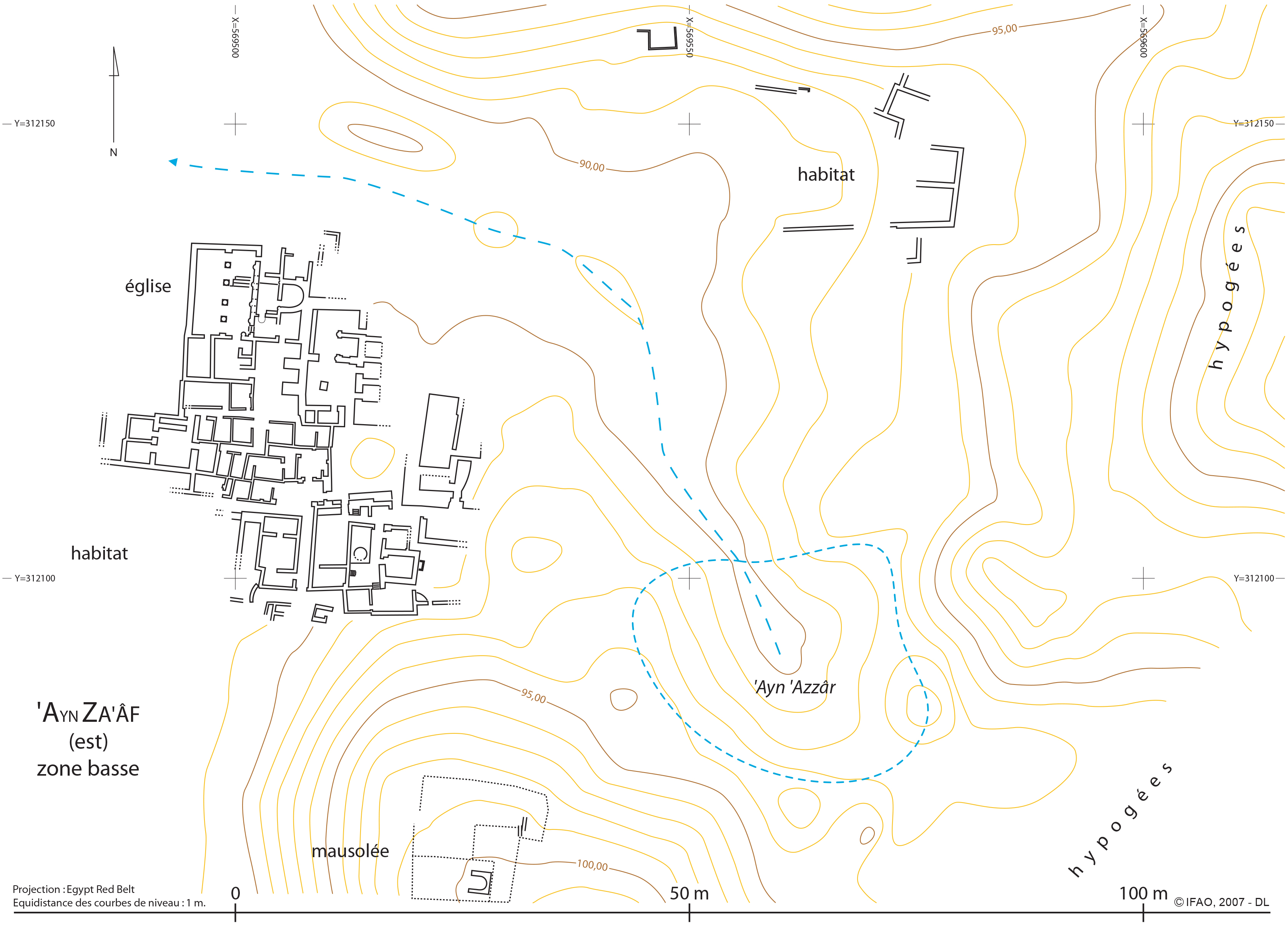
The site of ʿAyn Saʿaf is located 1.5km north of Dayr Muṣṭafā Kāšif, on the foothills of the western slope of the Ǧabal al-Ṭayr. It is divided into two distinct sections, one in the east and one in the west. The eastern section is concentrated around a residential area established near ʿayn rūmānī (ʿAyn ʿAzzār) and surrounded to the north, east and south by several funerary facilities (rock-cut tombs, mausoleums or simple burials without superstructures) (Ghica, 2012: 222). The initial plan of the housing sector appears to be dominated by two buildings, that of a church in the north-west corner (the size of the which indicates that a large part of the habitation area must be covered), and a vaulted room oriented north south. Due to lack of excavation reports, the function of spaces and their arrangement cannot be determined. The state of preservation, however, enables the identification of numerous construction phases which affected several complexes. Greek ostraca found during the clearing of the site suggest that a Pacomian community was operational here in the 5th century. Arguing in favour of the monastic nature of the site is a dipinto left in the eastern part of the apse which gives the names of nineteen monks. Another Coptic dipinto suggests that after the Arab invasion the site was occupied by laity; inscribed on the late wall which limits the opening of the conch invokes a term which usually designates a civil servant (Ghica, 2012: 224).
The western section comprises a small farm, established in the center of ancient plots irrigated by water systems from the neighbouring hydreuma. In the south-east corner of the domestic structure are the remains of a small church, which is in considerably good condition. The structure is oblong with a column in the center of the nave, with what was originally a rectangular apse. Three Greek graffiti of a Christian nature appear to be contemporary with the period of activity of the church (Ghica, 2012: 227). The two sectors appear to have been contemporary, at least for some time. The occupation of the nearby tower of Ṭāḥūnat al-Hawā is not known (Ghica, 2012: 224).
Archaeological research
According to Mansūr ʿUṯmān, former head of the Copto-Islamic inspectorate of the SCA in Kharga, local inspectors carried out a partial clearing of the site during two seasons, in 1988-1989 and 1989-1990 (Ghica 2012: 222, n. 184). However, other dates were published elsewhere (Leclant, Clerc 1989: 405 and n. 384). No excavation report was ever published. The Institut français dʼarchéologie orientale ran four short study campaigns on the site: March and September 2007 (V. Ghica), September (V. Ghica, D. Laisney and J. Westerfeld) and December 2008 (V. Ghica, S. Marchand and M. Wuttmann). These study periods resulted in: the mapping of the archaeological structures and the relief of the site, a ceramic survey, and sampling of mudbricks for radiocarbon analysis.
Bibliography
•Capuani, M. 1999. L’Égypte copte, 232. Paris: Citadelles. •Cruz-Uribe, E., P. Piccione and J. Westerfeld. 2004. “Kharga Oasis Coptic Graffiti Project. Preliminary Report of the 2005 Field Season.”Journal of the Society of the Studies of Egyptian Antiquities 31: 38-40. • Ghica, V. 2012. “Pour une histoire du christianisme dans le désert Occidental d’Égypte.” Journal des savants 2012/2: 222-227. • Ghica, Victor. 2019. “L’archéologie du monachisme égyptien au IVe siècle: état de la question.” In Nag Hammadi à 70 ans. Qu’avons nous appris ? Nag Hammadi at 70: What Have We Learned? (Colloque international, Québec, Université Laval, 29-31 mai 2015), edited by E. Crégheur, L. Painchaud and T. Rasimus, 131. Leuven–Paris–Bristol: Peeters. •Leclant, J., G. Clerc. 1989. “Fouilles et travaux en Égypte et au Soudan, 1987-1988.”Orientalia 58: 405. •Mu?ller-Wiener, W. 1963. “Christliche Monumente im Gebiet von Hibis (el-Kharga).”Mitteilungen des deutschen archäologischen Instituts. Abteilung Kairo 19: 137.
Authors
Victor Ghica,
Rhiannon Williams, 2021
Suggested citation
Victor Ghica,
Rhiannon Williams, 2021,
"ʿAyn Saʿaf", 4CARE database - Fourth-Century Christian Archaeological Record of Egypt,
https://4care-skos.mf.no/places/57


 Json data